
Feature your business, services, products, events & news. Submit Website.
Breaking Top Featured Content:
More thunderstorms in Monday forecast
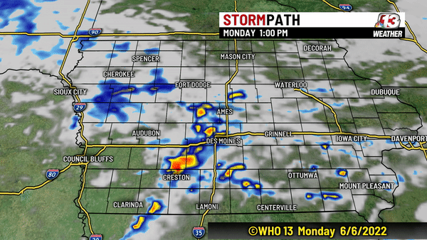
IOWA — After storms brought more than 3″ of rain to parts of the Hwy 30 corridor Sunday night, we are looking ahead to the next several days ahead when more rain is expected.
Monday
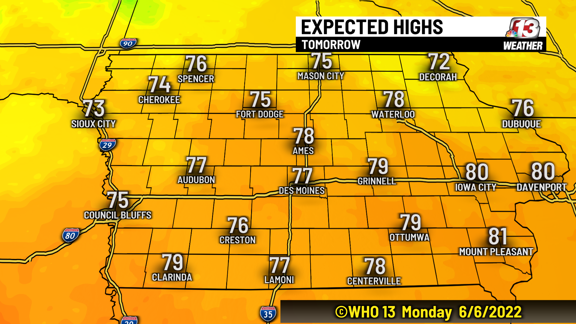
A few additional showers and thunderstorms are possible today but will be limited to central and southeast Iowa. Isolated storms with up to 1″ hail are possible. Expect highs in the mid to upper 70s by the afternoon.
Tuesday
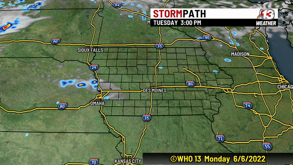
Another warm front will approach the state on Tuesday which will bring another chance for storms in Iowa. Tuesday does look to start dry and partly sunny with temperatures in the 50s. Most of the afternoon will also be dry with highs in the 70s. Storm chances will increase especially after 7 pm.
Most of the state will pick up a tenth of an inch of rain with some spots in western Iowa getting as much as a half inch.
Wednesday
High pressure will move in on Wednesday and sunshine will return across Iowa for a day or so. The wind will stay relatively light out of the northwest with highs reaching the middle 70s.

Thursday
Storm chances will return on Thursday, but the majority of the day still looks mainly dry. The morning will be mostly sunny, but clouds will increase during the afternoon and evening and highs will climb into the upper 70s. Storms will arrive late bringing up to 1″ along parts of the Missouri River in western Iowa. Much of central Iowa looks to see up to a half inch of rain late Thursday into early Friday.
Overall totals over the next 5 days will range from 0.50″ to 1.50″.
Continue Reading at WHO13.com here