
Feature your business, services, products, events & news. Submit Website.
Breaking Top Featured Content:
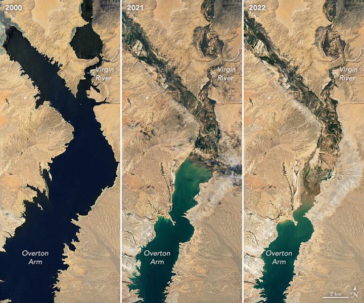
NASA Satellite Images Reveal Lake Mead’s Dramatic Water Loss
NASA published new satellite images that show a massive drop in water levels over the last two decades at Lake Mead.
“Continuing a 22-year downward trend, water levels in Lake Mead stand at their lowest since April 1937, when the reservoir was still being filled for the first time,” NASA wrote in a press release.
The largest artificial reservoir in the US was just 27% full as of Monday, and water levels have been steadily declining since the start of the year, down more than 26 feet to 1,040 feet.
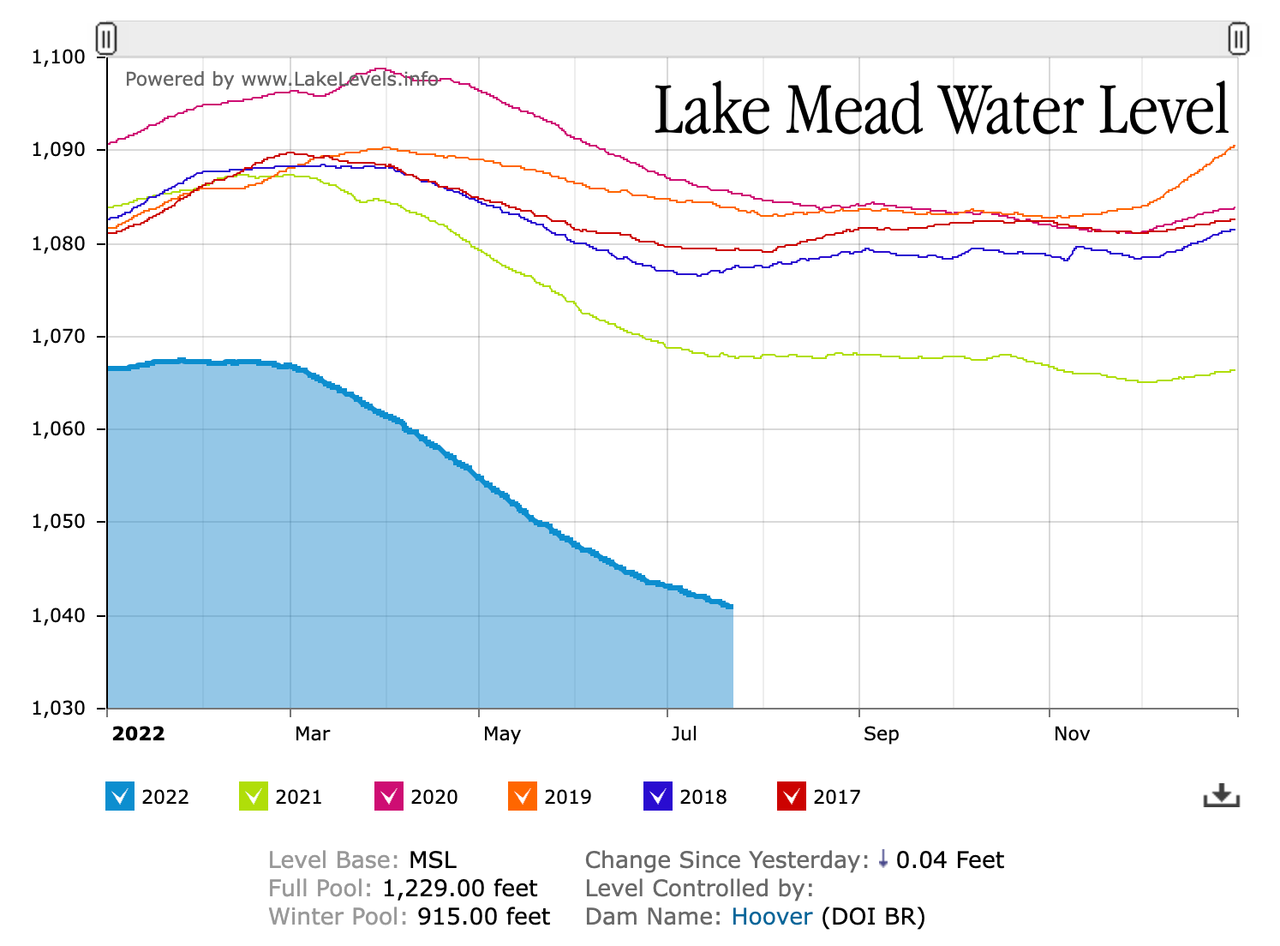
The photos shared by the NASA Earth Observatory — taken by Landsat 7 and Landsat 8 — provide a new updated view of the trend for Mead which suggests water levels could fall even more.
For more context of what has happened over the last two decades as a megadrought grips the US West, here’s a view on the ground from May to June, showing just how quickly the water has dropped.
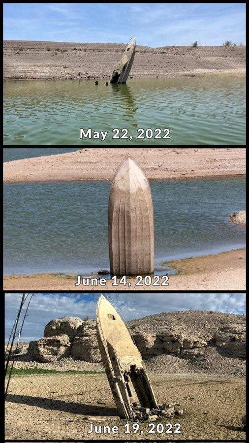
The water level is dropping so quick that houseboats are stranded.

Last month, we outlined how the drought-stricken lake is 149 feet from a dangerous level known as a “dead pool” and could wreak havoc across Southwestern US.
If Lake Mead were to keep dropping, it could be a couple of years until a danger zone at 895 feet is reached, which is the point water would no longer pass through Hoover Dam to supply California, Arizona, and Mexico. Below 895 feet, the lake would be considered a “dead pool.”
Corporate media routinely blames receding waters on climate change’ — perhaps the creation of the artificial lake in the middle of a desert has something to do with it…
Tyler Durden
Fri, 07/22/2022 – 15:40
Continue reading at ZeroHedge.com, Click Here.