
Feature your business, services, products, events & news. Submit Website.
Breaking Top Featured Content:
Memorial Day tornadoes are possible in Iowa
Monday afternoon and evening
Storms are possible across Iowa this afternoon and evening with an elevated chance for tornadoes between 5 and 9 pm.
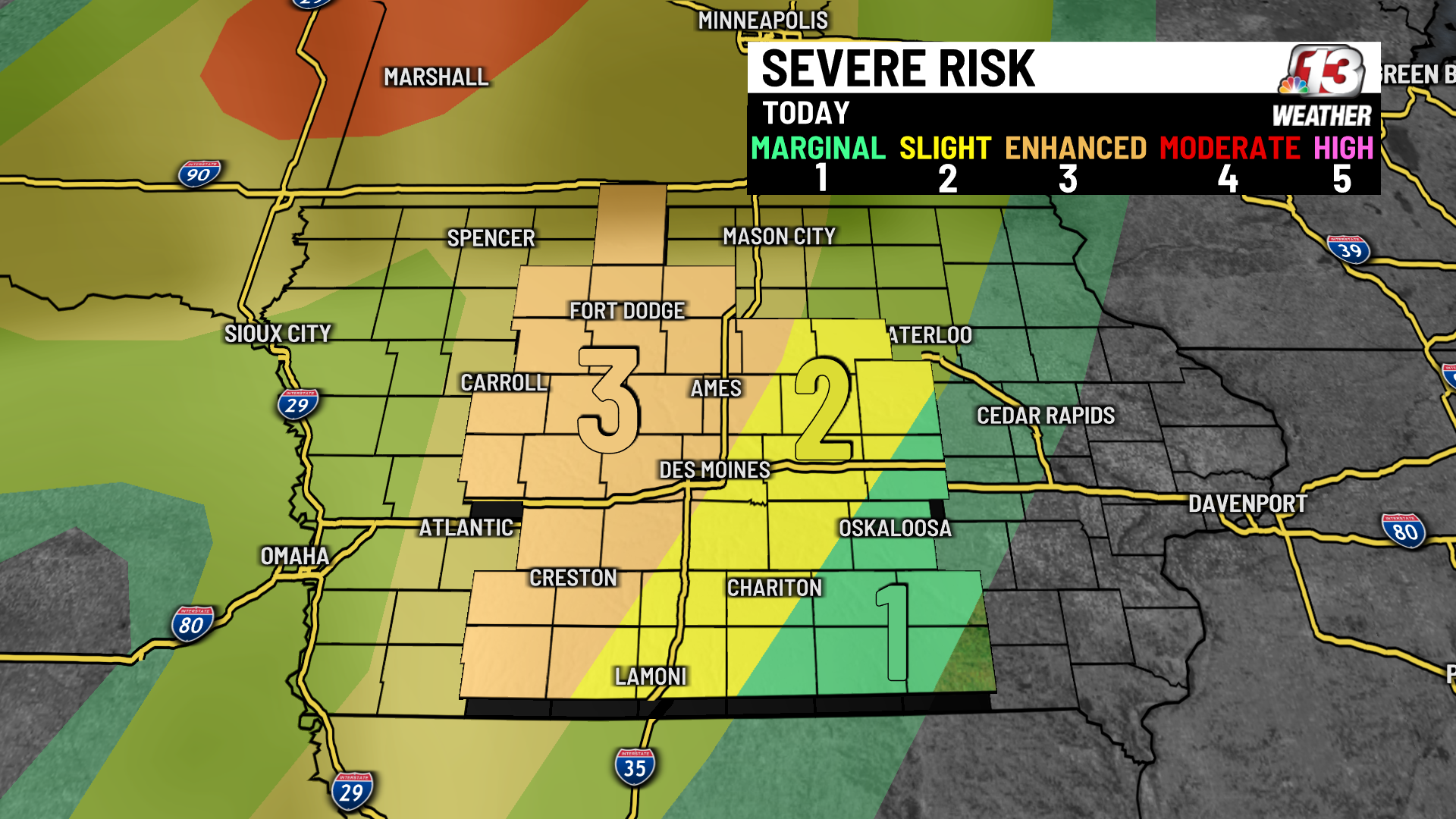
The risk across central Iowa ranges from a level 1 (marginal) out of 5 in our southeastern counties to a level 3 (enhanced) out of 5 across much of our western counties.
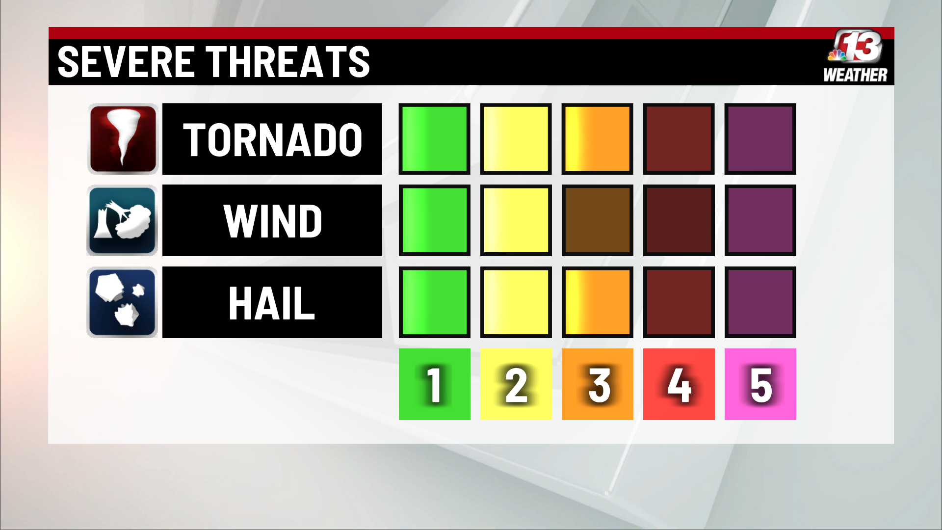
Level 1 (marginal)
Means: Isolated strong to severe storms are possible.
Includes: Grinnell, Oskaloosa, Ottumwa, and Corydon in SE Iowa.
Best chance for storms: after midnight
Level 2 (slight)
Means: Scattered strong to severe storms are possible. Most will be short-lived with isolated intense storms.
Includes: Marshalltown, Tama, Newton, Pella, Indianola, Osceola, Chariton, and Lamoni.
Best chance for storms: 10 PM-3 AM
Level 3 (enhanced)
Means: Numerous strong to severe storms are possible. May be longer lived with a few intense storms.
Includes: Algona, Pocahontas, Fort Dodge, Carroll, Boone, Ames, Audubon, Guthrie Center, Stuart, Des Moines, Greenfield, Winterset, Corning, Bedford, and Creston in west central Iowa.
Best chance for storms: 4-10 PM
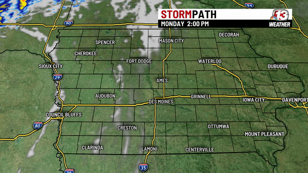
Storms will begin to form in NW Iowa around 4 PM with the strongest storms expected between 5 and 9 PM across the level 3 areas. This is the timeframe when tornadoes are most likely if all ingredients come together.
Overnight
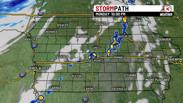
After 10 PM most storms will be along or just east of I-35. Strong to severe storms are possible with the main threats being large hail and damaging wind. Storms will weaken and dissipate after midnight as storms continue to move into eastern Iowa.
Stay tuned for more updates as storms begin to form this afternoon.
Continue Reading at WHO13.com here