
Weather Tools
Search Featured Websites:
Feature your business, services, products, events & news. Submit Website.
Breaking Top Featured Content:
Feature your business, services, products, events & news. Submit Website.
Breaking Top Featured Content:
Severe weather: Where in Iowa has the best chance today?
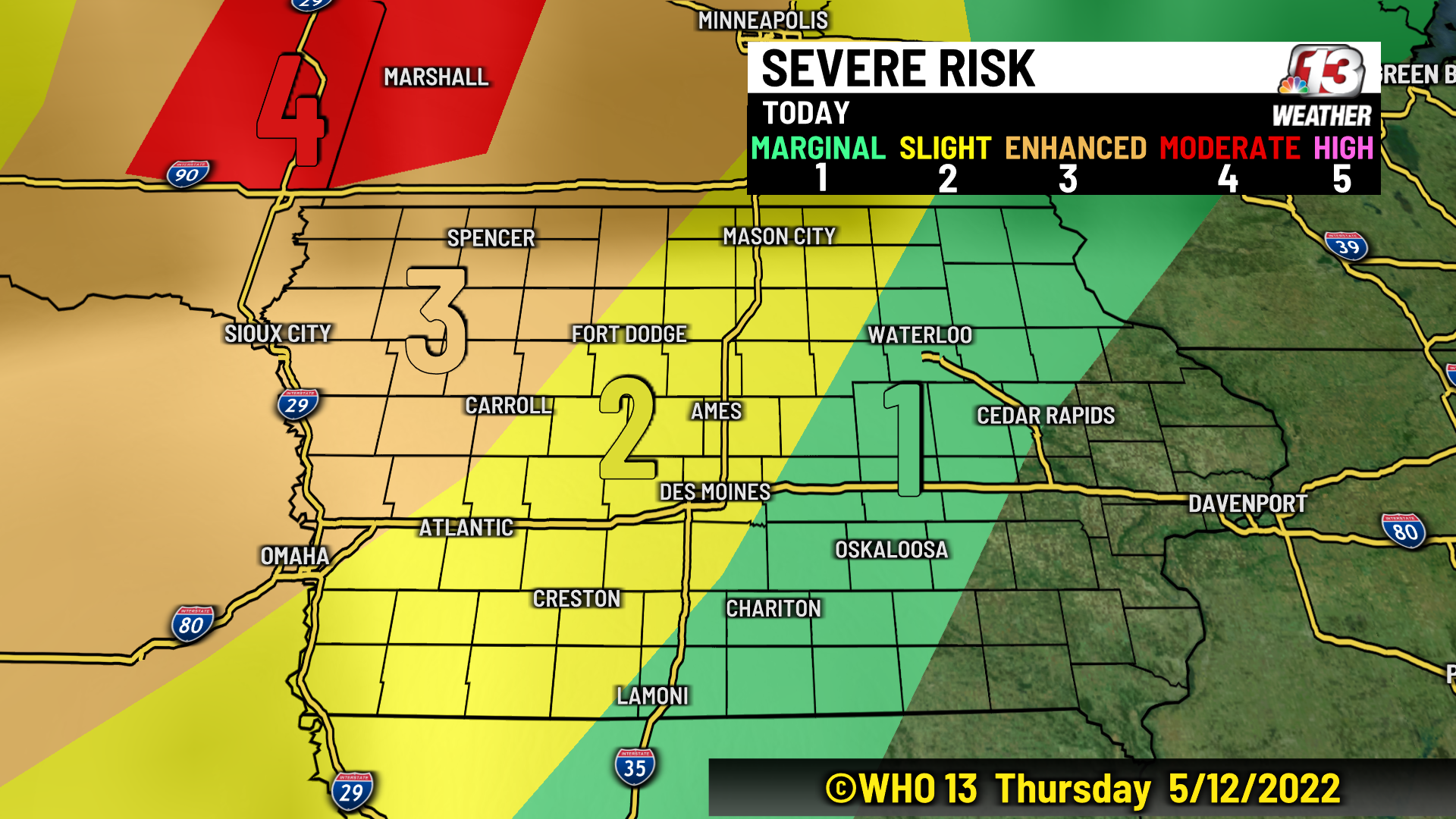
Another round of severe weather will move through the Midwest tonight with the best chance in eastern South Dakota and western Minnesota. However, severe storms are still possible late across parts of Iowa. The Storm Prediction Center has the WHO 13 viewing area (highlighted below) at a level 1-3 (out of 5) risk for severe weather.
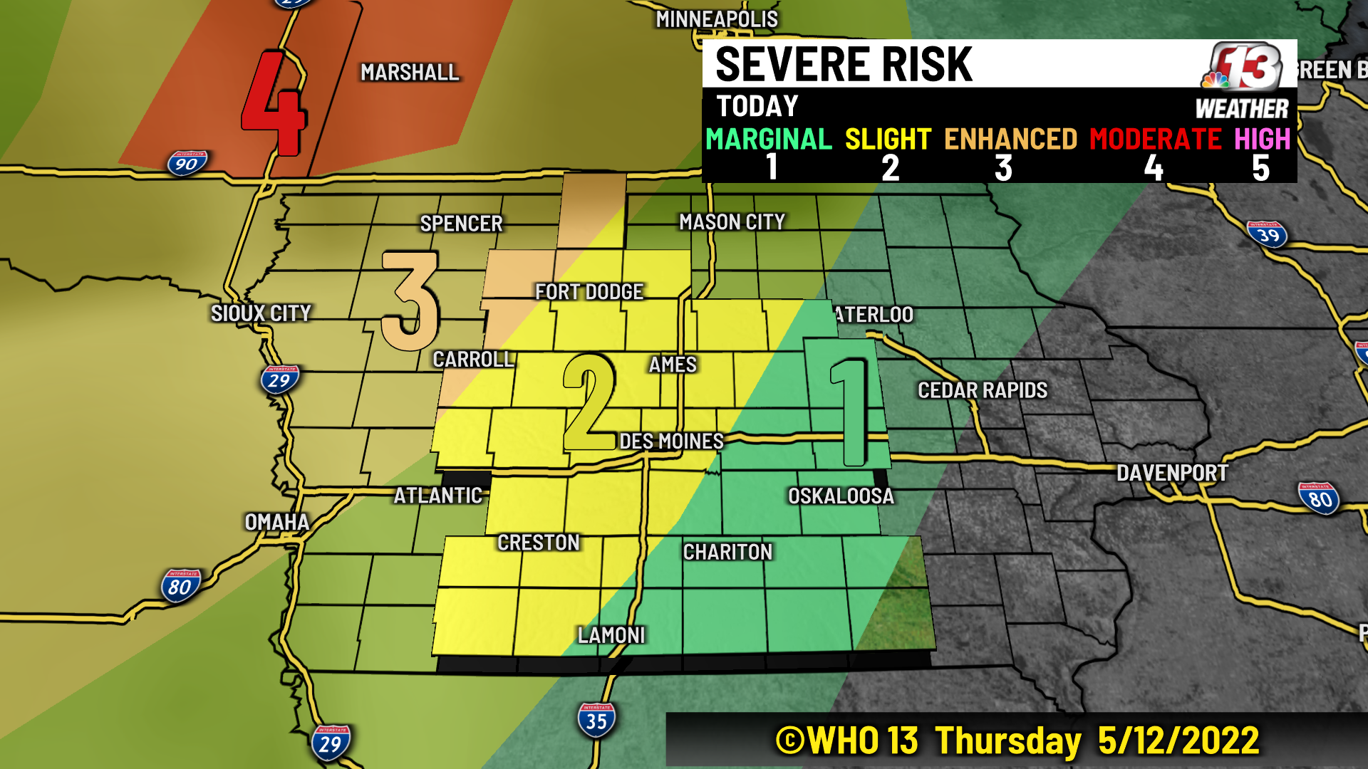
A level 3 (enhanced) risk is in place for much of NW Iowa including Kossuth, Pocahontas, Calhoun, and Carroll counties in the WHO 13 viewing area. This is where the best chance for severe weather exists across Iowa. Storms are most likely between 9 PM and midnight. Damaging wind remains the biggest threat in this area, but isolated tornadoes and large hail cannot be ruled out.
A level 2 (slight) risk includes much of central Iowa from Fort Dodge and Ames to Des Moines and Creston. Scattered showers and thunderstorms are possible after midnight and before sunrise in this area. Damaging wind is the main threat here. Tornadoes are unlikely.
The level 1 (marginal) risk extends across Marshall, Monroe, Lucas, and Decatur counties as well as the remaining counties east of this line. Isolated storms with gusty winds are possible in this area early Friday morning.

Storms will form in eastern South Dakota and central Nebraska this evening. This is when they will have the greatest strength. After sunset storms will weaken but continue to move east. NW Iowa has the best chance of seeing a few strong to severe storms before midnight, but the threat will subside as storms dissipate early Friday across central and eastern Iowa.
For more on the latest forecast check out www.WHO13.com/weather.
Continue Reading at WHO13.com here